Hike

Unlock to see location
Hiking trail in São Miguel
Category
Est. Duration
2-3h
Activity level
Message from Sergio
Want to see more?
I have created curated maps and itineraries for travellers that want to travel like me.
Nearby local secrets

Sightseeing
Miradouro da Boca do Inferno
Scenic viewpoint with stunning vistas

Sightseeing
Ilhéu de Vila Franca do Campo
Unique volcanic islet

Sightseeing
Unlock to see location
Breathtaking coastal views in Azores

Sightseeing
Miradouro da Vista do Rei
Breathtaking views of Sete Cidades

Sightseeing
Unlock to see location
Scenic viewpoint with friendly cats

Sightseeing
Miradouro da Lagoa do Fogo
Scenic viewpoint with stunning vistas

Park
Unlock to see location
Historic botanical park with thermal baths

Sightseeing
Unlock to see location
"Neo-Gothic chapel in enchanting setting."

Park
Unlock to see location
Educational nature oasis in Azores

Tours
Sete Cidades: Kayaking and Pedalboat Adventure
Adventure in the Azores paradise

Tours
Whale and Dolphin Watching Trip
Adventure-filled travel in Azores

Tours
Sete Cidades Bike Rental
Adventure and nature in Azores

Tours
Full-Day East Tour with Lunch
Top-quality tours in Azores

Tours
Quad&Buggy Tours
Adrenaline-pumping outdoor adventure in Azores

Tours
Full-Day West Tour with Lunch
Professional tours in Azores Islands

Park
Unlock to see location
Hiking paradise in Azores nature

Park
Unlock to see location
Picturesque nature park with waterfalls

Sightseeing
Unlock to see location
Tranquil orchard near Furnas Lake
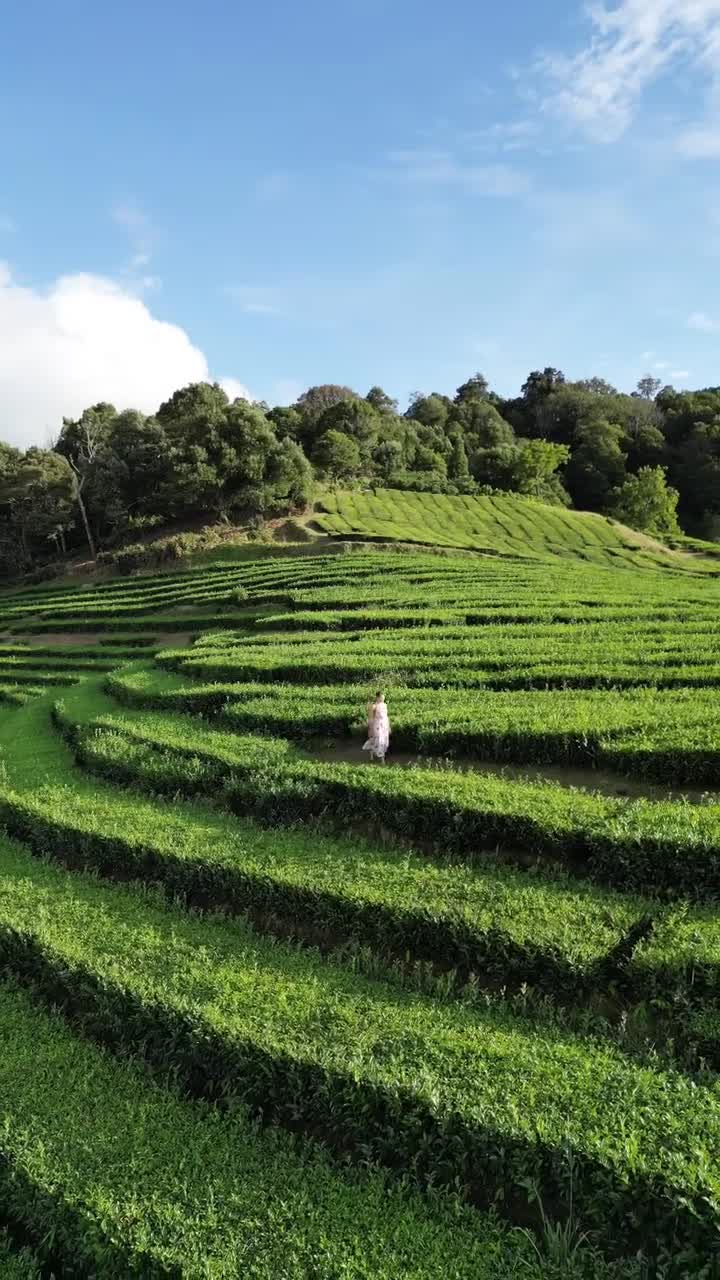
Museum
Unlock to see location
"Oldest European tea plantation tradition."

Activity
Unlock to see location
Thrilling outdoor adventures in nature

Museum
Unlock to see location
Tea factory museum in Azores

Photospot
Unlock to see location
Abandoned luxury hotel in Azores

Sightseeing
Unlock to see location
Historic stone warehouse with nine windows

Sightseeing
Unlock to see location
Hidden gem with stunning views

Looking for things to do?
Go check out my guide for the best free things to do as well as itineraries and travel tips to make your trip unforgettable.
Go to Guide
Rexby was founded in 2021 with the mission of enabling travel content creators to provide a better service and capture more of the immense value they are creating for the tourism industry
Backed by
Our licence
Kt: 6909211460
Vsk: 146757
